TASMA Coordination Area
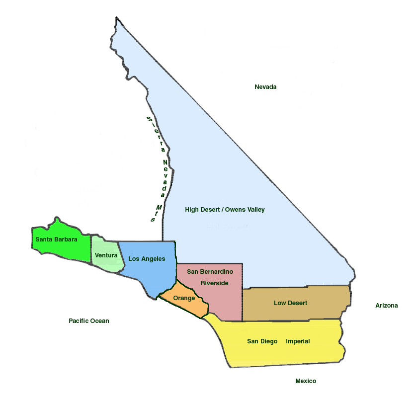
TASMA Coordination Area is defined as: the Pacific Ocean on the west; Mexico on the south; the combined Arizona-Nevada border on the east, extending up to the Mono-Alpine County line; then south along the Mono-Tuolumne County line, south along the Mono-Madera County Line, south along the Mono-Fresno County Line, south along the Fresno-Inyo County line, south along the Inyo-Tulare County line to the Kern County line, south along Highway 14 just a little west of the Kern-San Bernardino County line to the Los Angeles-Kern County line, then west along that line past the 5 freeway and along the Kern-Ventura County line to an area near the 33/166 intersection, then west along the Santa Barbara-San Luis Obispo County line to the Pacific Ocean.